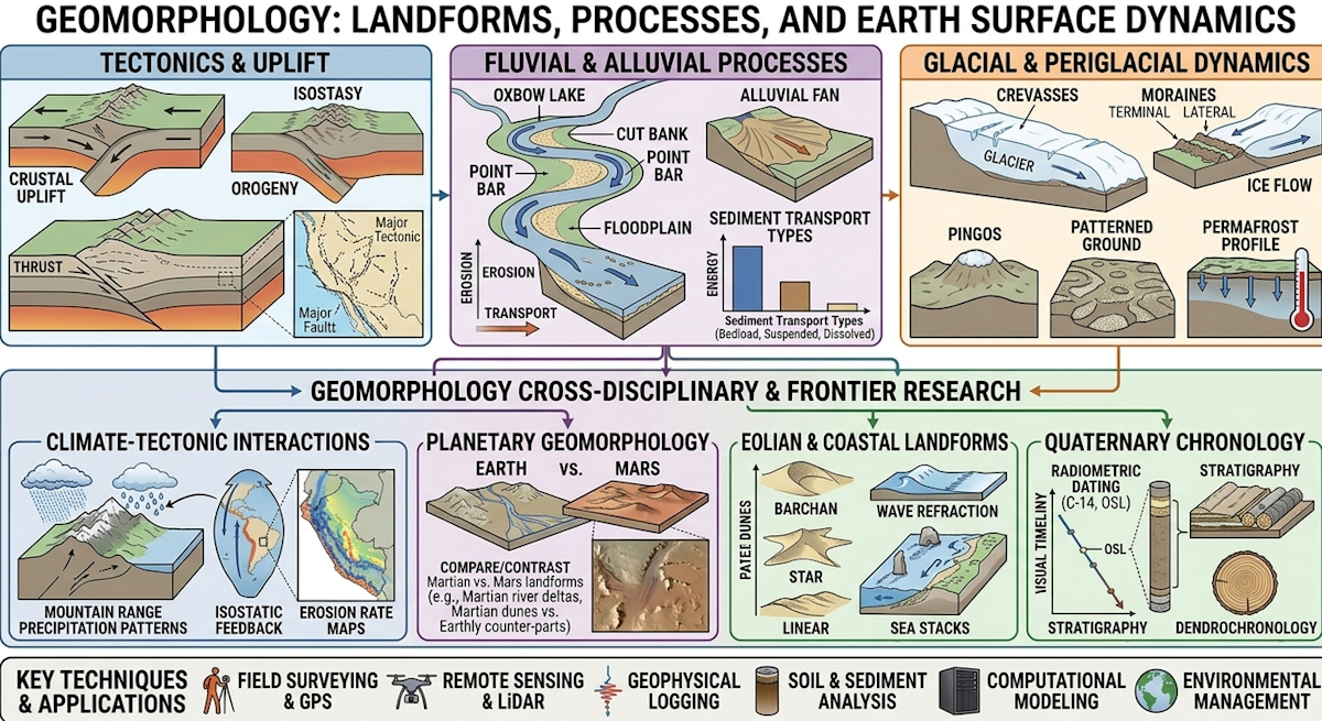
Geomorphology
Geomorphology increasingly integrates high-resolution remote sensing, LiDAR, and advanced numerical modeling to track landscape evolution and natural hazards in unprecedented detail. Recent advancements focus on understanding the complex feedbacks between climate change, tectonics, and surface processes to better predict landscape responses and mitigate environmental risks. Additionally, interdisciplinary approaches combining geomorphology with ecology and data science are driving more sustainable management of Earth's surface systems.
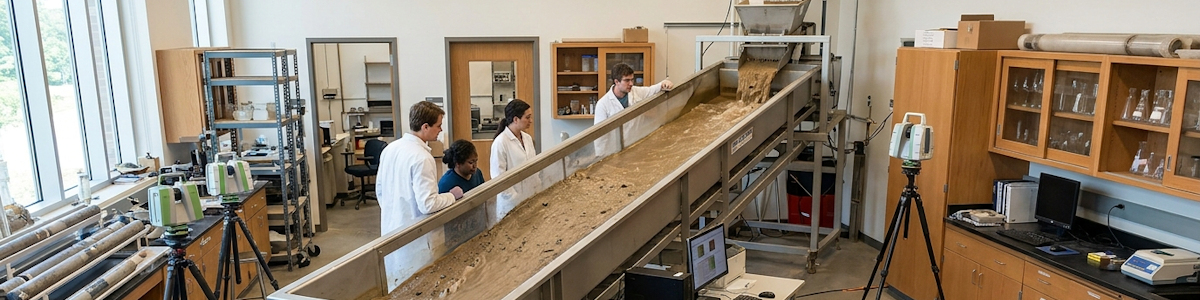
The Gilbert Earth Surface Processes Laboratory
The laboratory is dedicated to Grove Karl Gilbert, the American geologist who insisted landforms be measured rather than merely described, and who built flumes and dammed lakes to test his own ideas against nature — it forms the geomorphology unit of Analex Laboratories. Its concern is the shape of the land and the processes still carving it.
Core Capabilities & Equipment
- Recirculating Flume & Sediment Transport Laboratory: Tilting flumes with adjustable discharge and sediment feed, plus an open-circuit wind tunnel, stage bank erosion, bedload flux, dune migration, and grain-size sorting under controlled conditions, with particle-tracking velocimetry reading the flow field directly.
- Terrestrial Laser Scanning & Repeat-Topography Unit: Ground LiDAR, drone photogrammetry, and RTK-GNSS resurvey channels, scarps, and debris fans to centimetre accuracy, differencing successive point clouds to compute erosion and deposition volumes across a single storm season.
- Cosmogenic Nuclide & Luminescence Dating Laboratory: Beryllium-10 and aluminium-26 exposure ages from quartz, alongside optically stimulated luminescence on feldspar and quartz, date terrace abandonment, fan deposition, and glacial retreat, giving measured process rates a chronological frame.
- Hillslope, Soil & Catchment Monitoring Array: Dense erosion pins, sediment traps, soil-moisture probes, and turbidity sensors instrument instrumented catchments through full hydrological cycles, tying rainfall and infiltration to the sediment actually delivered at the outlet.
Geomorphology spent its formative decades classifying landforms; today it audits them. The shift is from describing what a valley looks like to computing where its sediment came from, how fast it is moving, and by which mechanism — a mass-balance exercise in which every eroded kilogram must be accounted for somewhere downstream. Analex Laboratories, a consortium of geomorphologists, hydrologists, geochronologists, and numerical modelers, has staked its reputation on that ledger-keeping. The group's working assumption is that landscapes are the visible expression of competition among uplift, climate, lithology, and biota, and that the competition is quantifiable if you measure long enough, densely enough, and at the right scales.
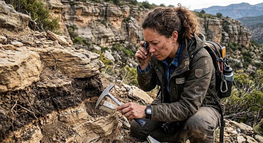
Measurement has become unrecognizably cheap and precise. Repeat airborne and terrestrial lidar, drone-based structure-from-motion photogrammetry, and multi-temporal satellite stereo let Analex teams difference entire catchments between surveys and detect centimeter-scale change on hillslopes, riverbeds, and dunes. Sediment gauging and turbidity sensing capture suspended and bedload flux in real time; seismic and acoustic sensors detect debris flows and bedload transport as ground vibration; GPS and strain instruments track slow rock creep preceding failure. Chronometry supplies the longer view: terrestrial cosmogenic nuclides yield catchment-averaged denudation rates over millennia, luminescence dating brackets terrace and fan abandonment, and uranium-series methods date speleothems and pedogenic carbonates. Together these bracket erosion from individual storms to glacial cycles.
Mechanistic work explains the numbers. Analex runs flume and rainfall-simulator experiments on hillslope soil production, threshold slope behavior, and rill-to-gully transition, and operates instrumented landslide and debris-flow catchments where pore pressure, root cohesion, and rainfall intensity are logged until failure occurs — then logged again afterward. Fluvial research ties channel steepness and width to discharge, grain size, and rock strength, tracking knickpoint retreat and the coupling between incision and adjacent hillslopes. Glacier and paraglacial programs quantify how quickly oversteepened valleys adjust once ice retreats, while coastal and eolian groups resolve shoreline response to wave climate, sediment supply, and sea-level trajectory. Every one of these threads is pursued with an eye on connectivity: how efficiently material actually reaches the sea rather than stalling in a fan, floodplain, or reservoir.
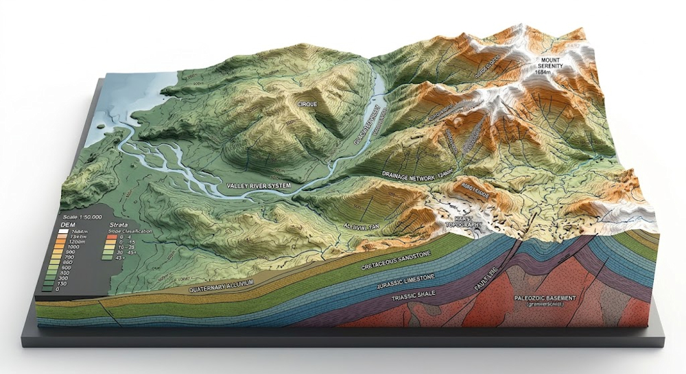
Upscale, the consortium builds and interrogates landscape evolution models, calibrating them against thermochronologic and cosmogenic datasets that record denudation over millions of years. Analex has pushed particularly hard on feedbacks — how river incision sets the pace of hillslope stripping, how orographic precipitation locks onto topography and then reshapes it, and how silicate weathering rates respond to erosion, coupling surface processes to the long-term carbon cycle and thus to climate. The group also works at the boundary where human activity has become a first-order geomorphic agent, treating agriculture, mining, dams, and urban grading as forcings comparable to tectonic or climatic ones.
Practical demands keep the field honest. Analex delivers landslide susceptibility mapping, debris-flow runout analysis, reservoir sedimentation forecasts, and coastal retreat projections, and advises on river restoration and floodplain reconnection where the objective is reinstating sediment continuity that past engineering severed. Sediment budgets matter equally for dam longevity, navigation, and delta maintenance, and for carbon storage in floodplain soils. A comparative-planet branch reads Martian gullies, Venusian channel networks, and Titan's fluvial systems as natural experiments on how gravity, atmosphere, and substrate alter familiar processes. The consortium's operating principle is simple arithmetic: a landscape that is losing more material than it gains is telling you what happens next, provided you have bothered to count.