Seismology & Geophysics
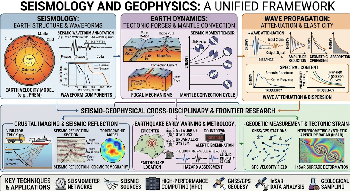
Seismology and geophysics focus on imaging Earth's interior and monitoring tectonic hazards through advanced instrumentation and high-performance computing. Recent technological breakthroughs, such as distributed acoustic sensing (DAS) and machine learning-driven seismic monitoring, have revolutionized real-time earthquake early warning and subsurface imaging. These developments empower scientists to map geological structures with unprecedented precision, ultimately enhancing hazard mitigation and resource exploration.
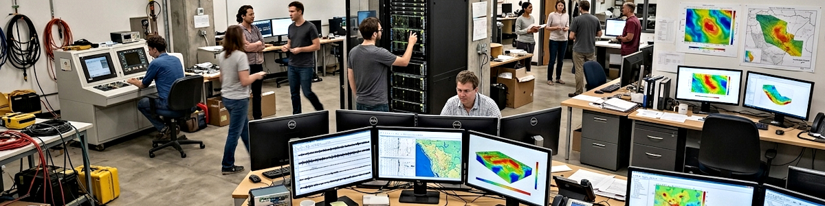
The Lehmann Deep Earth Imaging Laboratory
This facility takes its name from Inge Lehmann, the Danish seismologist who read a stubborn handful of seismic arrivals as proof of a solid inner core and handed the planet its deepest known boundary — and it forms the seismic and geophysical survey arm of Analex Laboratories. The center couples permanent and temporary network data with controlled-source experiments, chasing structure from the sediment pile down to the core-mantle boundary.
Core Capabilities & Equipment
- Broadband Seismic Array & Real-Time Data Center: Several hundred three-component broadband and short-period stations deploy on demand across a target region, streaming continuous ground motion into an acquisition hub where automated phase pickers and magnitude estimators run without operator input.
- Tomographic Imaging & Full-Waveform Inversion Cluster: A GPU cluster inverts complete seismograms — body waves, surface waves, and their coda — for three-dimensional velocity, attenuation, and anisotropy structure, resolving slab geometry, mantle upwellings, and the topography of the core-mantle boundary.
- Controlled-Source Active Survey Unit: Vibroseis trucks, marine airgun arrays, and ocean-bottom seismometers generate and record deliberately sourced energy, producing reflection and refraction profiles of basin fill, detachment faults, and Moho depth at vertical resolution passive recording cannot reach.
- Potential Fields & Electromagnetic Geophysics Bay: Airborne gravity gradiometry, drone-borne magnetics, and magnetotelluric sounding map density, susceptibility, and resistivity contrasts at depth, imaging intruded bodies, geothermal reservoirs, and fluid pathways precisely where seismic returns go quiet.
Seismology is, at its core, an inverse problem: reconstruct an invisible interior from waves that have already finished traveling through it. What has changed is the resolution, the speed, and the ambition of that reconstruction. Analex Laboratories, a consortium of seismologists, potential-field geophysicists, geodesists, and computational scientists, has organized its research around the proposition that the solid Earth can be imaged, monitored, and in places forecast with the same rigor applied to medical tomography — continuously, in three dimensions, and increasingly in real time. The group's scientists treat the wavefield not as a nuisance to be picked apart for arrival times but as an information-rich signal whose coda, scattering, and polarization encode structure and stress at every scale.
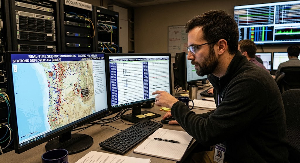
Getting that signal out of the noise is a hardware and data-science undertaking before it is anything else. Analex operates dense nodal deployments and ocean-bottom arrays, and has become a heavy user of distributed acoustic sensing, converting existing telecom fiber into thousands of virtual strain sensors at meter spacing. Machine-learning phase pickers, denoising autoencoders, and matched-filter template scanning now run continuously across the consortium's archives, surfacing small events that classical detection discarded — the microseismic background that reveals fault creep, fluid migration, and volcanic unrest. Data volumes are handled through automated quality control and cloud processing pipelines, letting a handful of analysts supervise networks that would previously have demanded dozens.
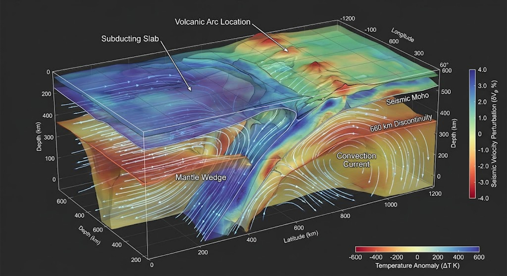
Deep Earth imaging remains the intellectual center of gravity. Using adjoint-based full-waveform inversion on regional and global datasets, Analex resolves mantle discontinuities, subducted slabs, and the heterogeneous structures sitting atop the core-mantle boundary — ultra-low-velocity zones, large low-shear-velocity provinces — and cross-checks each inversion against mineral-physics constraints on composition and temperature. Receiver-function stacks, shear-wave splitting, and attenuation tomography probe lithospheric thickness and mantle anisotropy, turning fabric and flow direction into observable quantities. Inner-core anisotropy, post-perovskite stability, and the thermal boundary layer at the base of the mantle are pursued as a single coupled problem spanning seismology, mineral physics, and geodynamics.
The consortium devotes comparable effort to the source side of the equation. Rupture kinematics, directivity, and stress-drop estimation are extracted through finite-source inversion and back-projection of teleseismic arrays, sharpening rupture-dynamics models of how slip accelerates, arrests, and jumps between fault segments. Analex's slow-slip and tremor program treats the aseismic half of the earthquake cycle as a first-class phenomenon rather than a curiosity, while induced seismicity from fluid injection and geothermal operations is modeled with coupled poroelastic simulation. Ground-motion prediction, site-response characterization, basin amplification, and liquefaction susceptibility feed directly into probabilistic hazard assessments, and the group contributes to regional early-warning systems where the interval between first detection and arriving shaking is measured in seconds.
Beyond pure research, the toolkit is commercially and socially load-bearing. Controlled-source and passive seismic methods guide geothermal reservoir definition, mineral exploration, and the monitoring of sequestered CO₂, where time-lapse imaging must detect subtle velocity changes across a caprock. Gravity, magnetic, magnetotelluric, and heat-flow data are inverted jointly with seismic results to reduce non-uniqueness, an approach Analex applies from cratonic margins to offshore basins. A planetary arm of the consortium interprets marsquake records, lunar seismicity, and gravity-field harmonics to constrain internal layering on other bodies, using the same inversion machinery pointed outward. The consortium's conviction is that the next generation of geophysics will be judged less on the elegance of its models than on whether those models hold up when the ground actually moves.